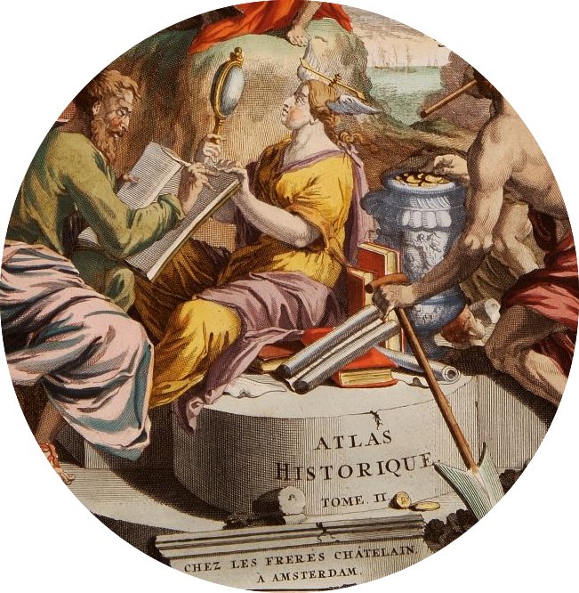
Sorry about the long delay (occasioned by computer troubles and the Thanksgiving break). Today I thought I’d share some of the research I did this summer into how images of animals, plants and peoples were embedded in early modern European maps of Africa, Asia and the New World.
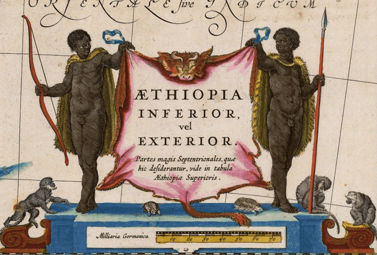
In many maps, the bulk of these images are contained in baroque ‘cartouches’ (borders or decorative framing elements) or in the ornate title-sections. An example of this can be seen in the above detail from a map of east Africa made by the famed Dutch cartographer Willem Janszoon Blaeu in the early seventeenth century. The overall design is generic, but the details – bearded macaques, small turtles, a cow skin and the two framing figures bearing bow and spear — offer a tiny window into the natural and human landscape of Ethiopia as it was imagined by the Dutch Golden Age.
 |
| Detail of European and Asian merchants, from a map by Chatelain. |
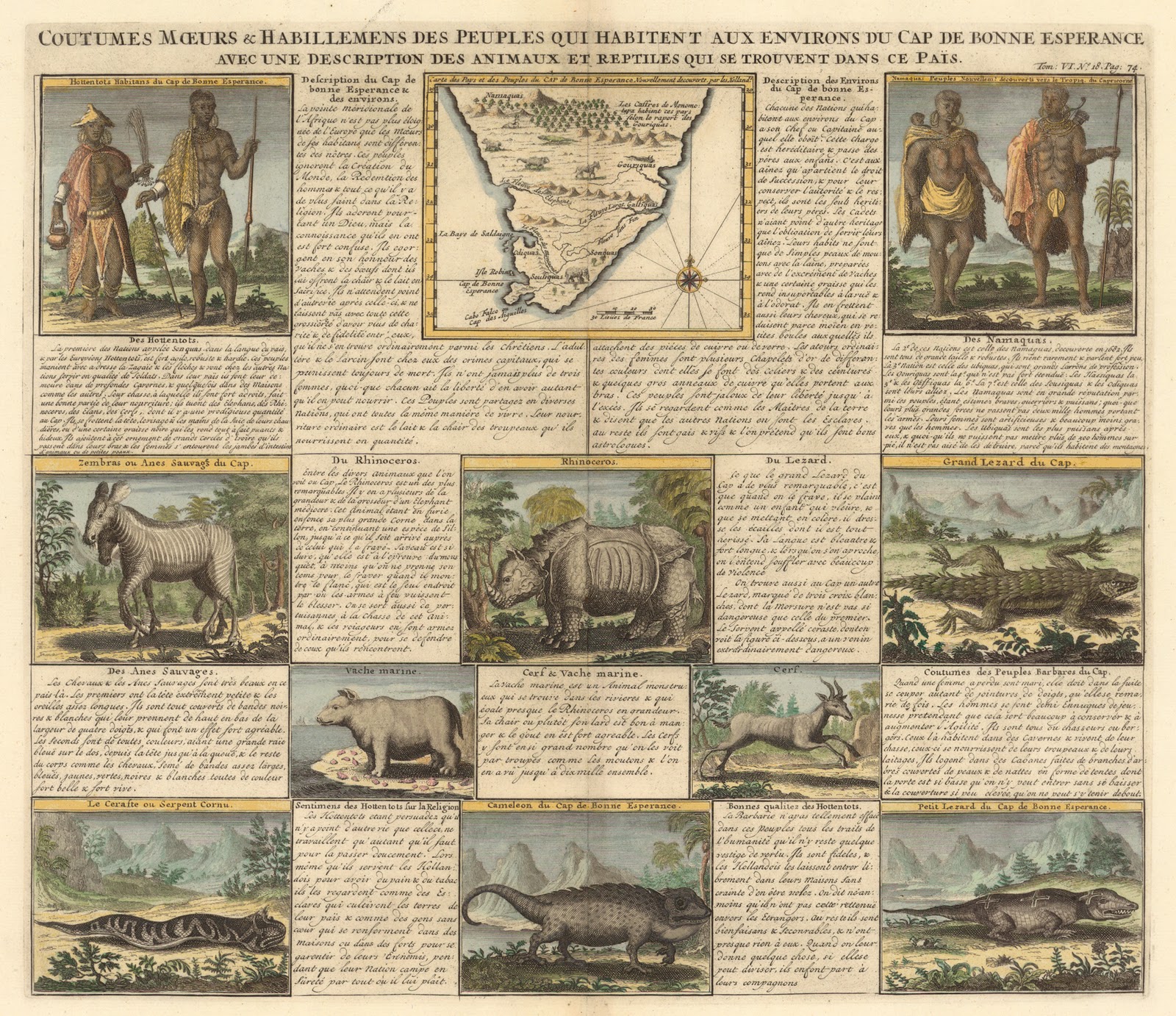 |
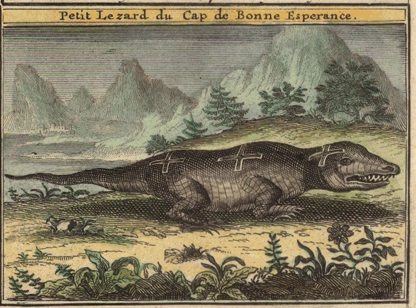
| Click to Enlarge. English translation of title: “Customs, manners and costumes of the people who inhabit the environs of the Cape of Good Hope, with a description of the animals and reptiles to be found in this region.” |
Some details, with some attempts at translations from the French:

“The first of the Nations named Sonquas in the language of the country, and called by Europeans Hottentons, is highly agile, robust and hardy. These peoples… serve the other nations as soldiers. In their country there are deep caverns… They are greatly adept in the chase and derive a good part of their nourishment from hunting; they slay Elephants, Rhinos, Elks and Deer, of which there is a prodigious number in the Cape…”
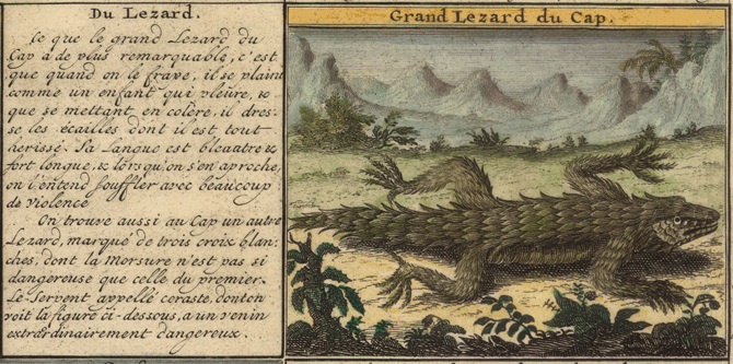
“What makes the big lizard in Cape Town most remarkable, is that when one strikes it, it cries out like a child, and it is sent into a rage [mettant en colere], drawing up its scales which are all a-bristle. Its tongue is blue-ish and extremely long, and when it approaches, it breathes [? souffler] with a great deal of violence…”


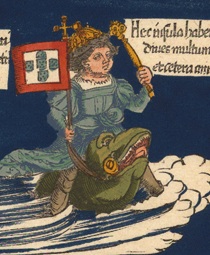
As an aside, its interesting to compare Chatelain’s map of South Africa with the 1541 Waldseemüller map. Both are somewhat fanciful, but as you can see below, the 1541 map is somewhat more so: note the three dragons that dwell in the center!


The old script makes the Latin difficult for me to read, but below the dragons it says something like, “Underneath the mountains there are Basilisks and Merguli[?], and it is almost entirely deserted on account of these.”
I’m also a fan of the 1541 map’s lower right corner, which for some reason seems to depict Manuel of Portugal (“Emmanuelis Regis Portigalliae”) surfing on a sea-frog off the coast of Madagascar!
Chatelain’s Atlas Historique is now extremely rare and pricey and seems not to have been reprinted in a modern edition, but the works of Blaeu, the great cartographer of the Dutch Golden Age, are available in some neat fascimile editions, such as these for France and Italy. J.B. Harley’s The New Nature of Maps (2002) is a good scholarly introduction to issues relating to cartography, power and science for those interested in learning more.
Nice informative content….